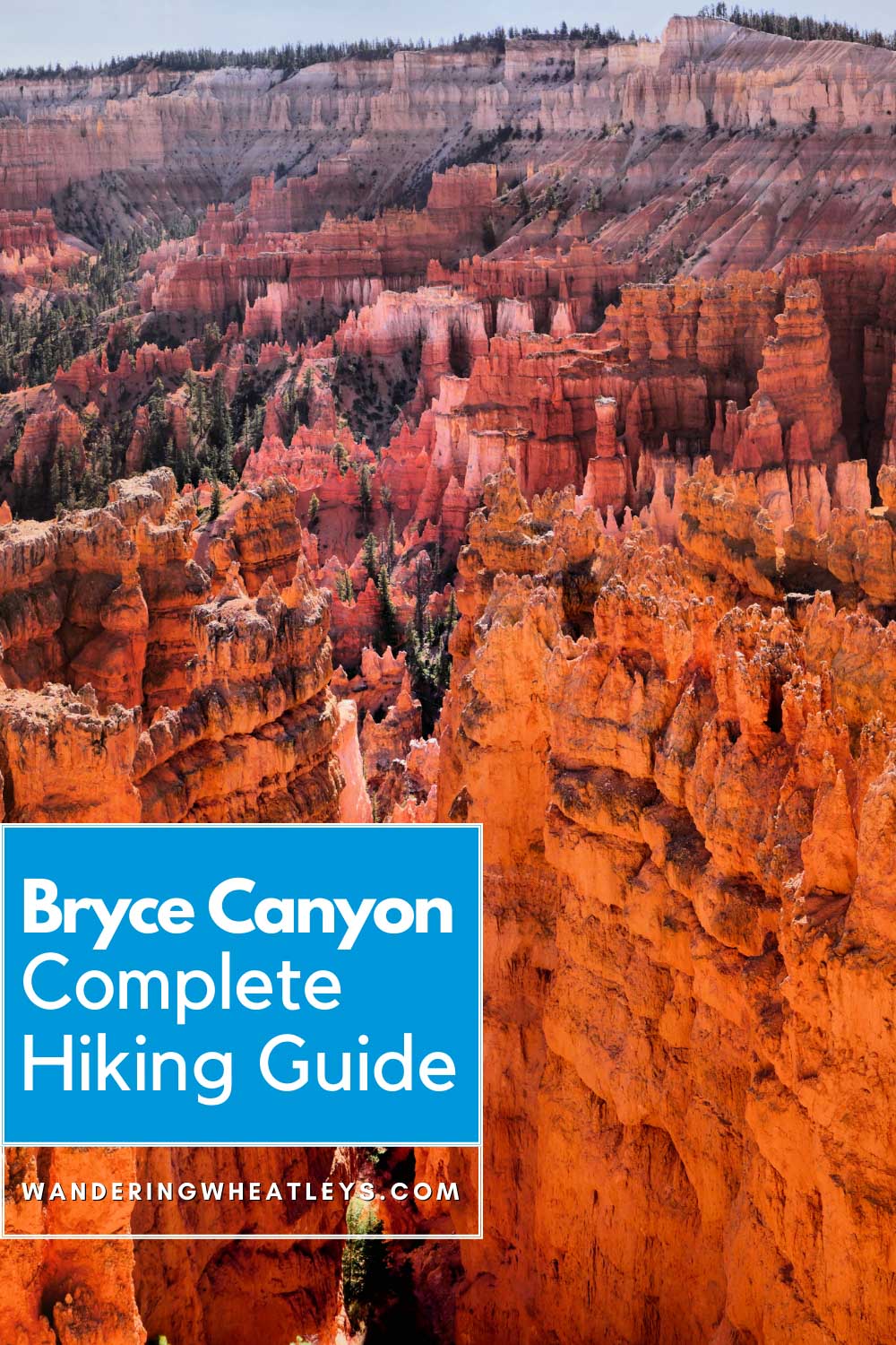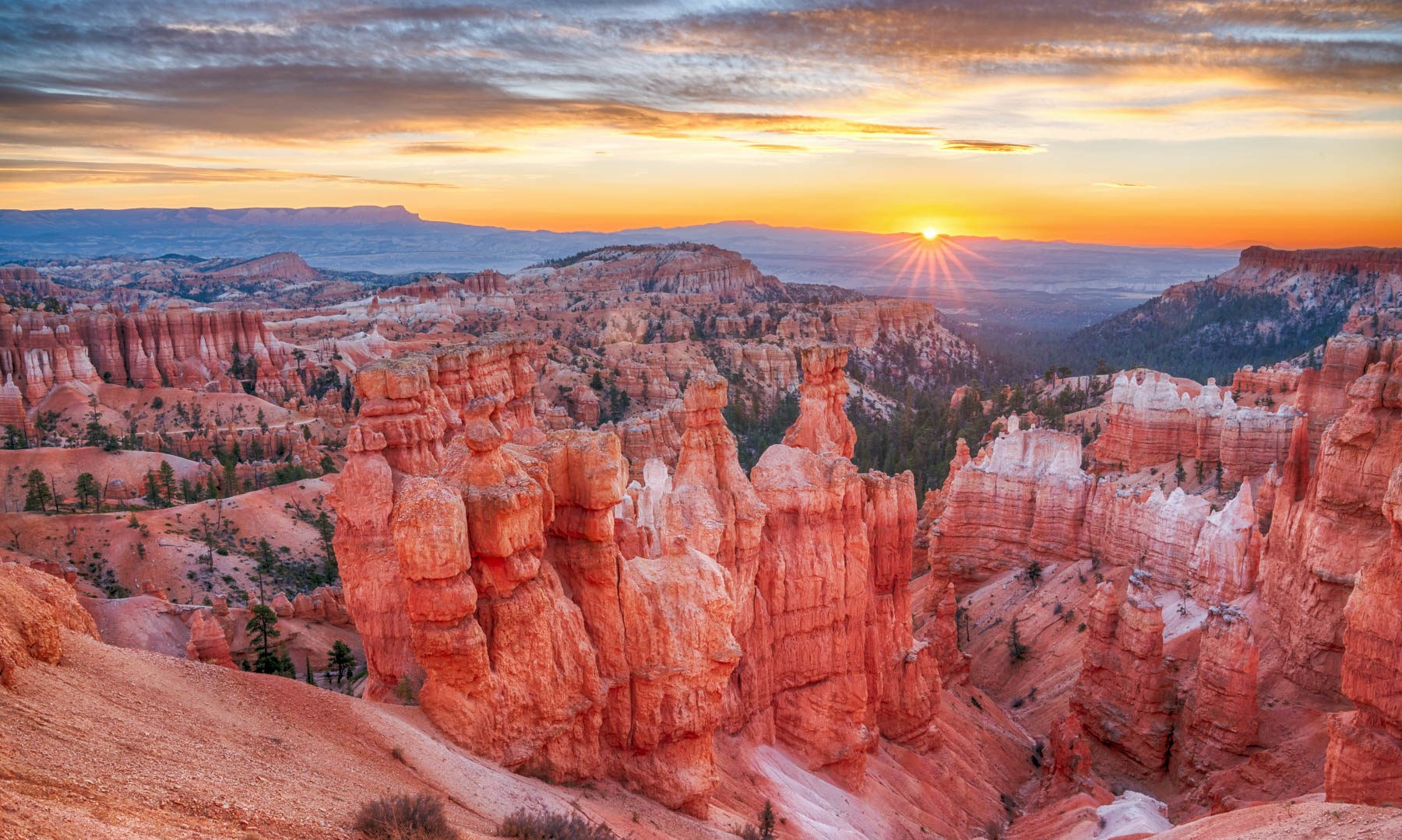
Bryce Canyon formed four million years ago from a large lake in what is now Western Utah. Millions of years of erosion have caused these plateaus to form small windows that eventually fell apart creating hoodoos and tall thin rock spires.
Nearly 200 days a year, the temperature goes above and below freezing between day and night, causing frost and increased erosion levels. Hoodoos dominate this park and over centuries, a giant amphitheater was formed.
The beautiful scenery is a photographer’s dream. Hiking Bryce Canyon is another perfect way to explore the park and get up close to the giant hoodoos. Check out our hiking guide to Bryce Canyon to plan your next hiking adventure!
Content and photographs provided by Yana Kogan and Timon.
Disclaimer: This post may contain affiliate links. If you make a purchase or booking through one of our links we may earn a small commission (don’t worry, it’s at no extra cost to you).
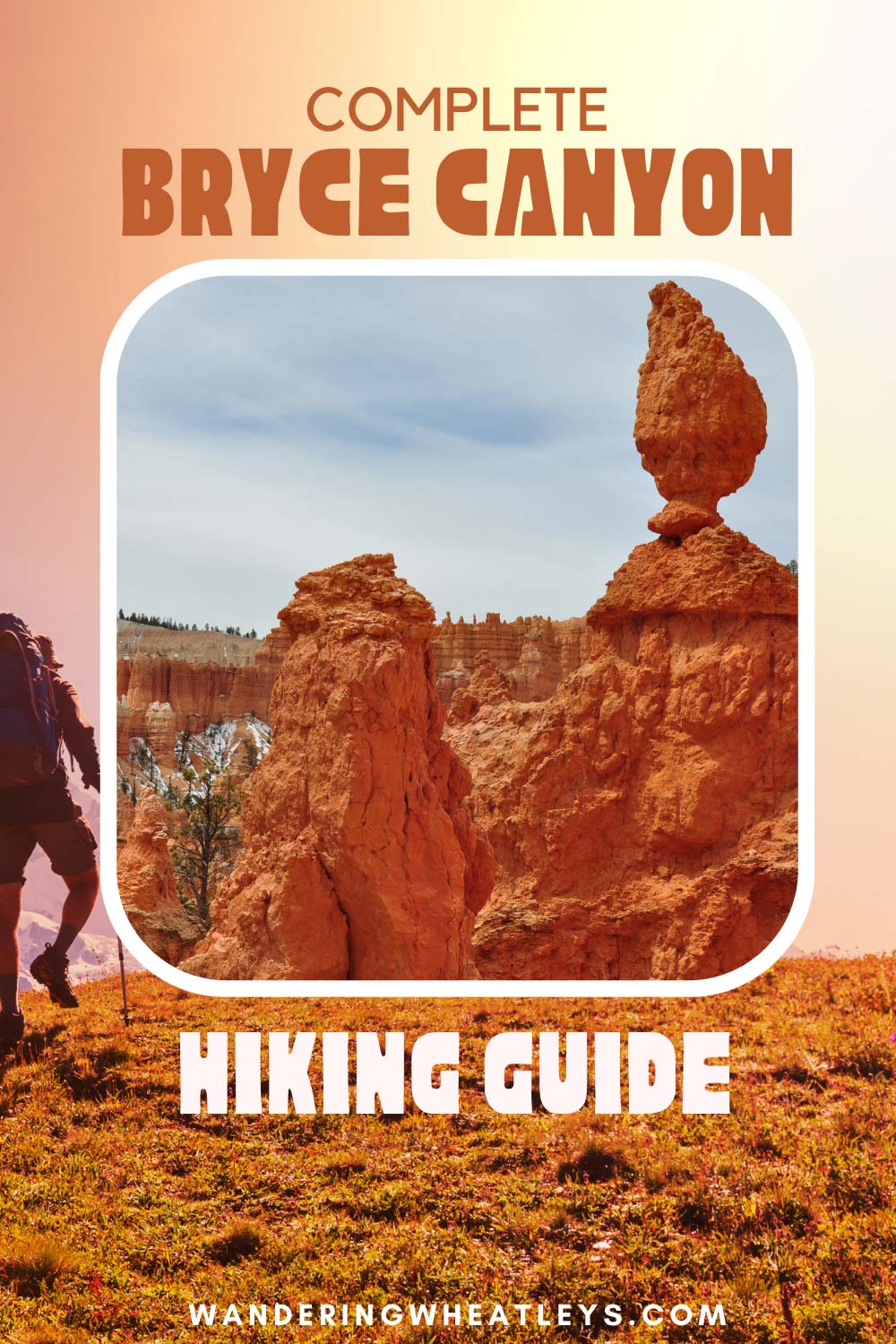
BRYCE CANYON HIKING GUIDE
Best Time to Visit Bryce Canyon
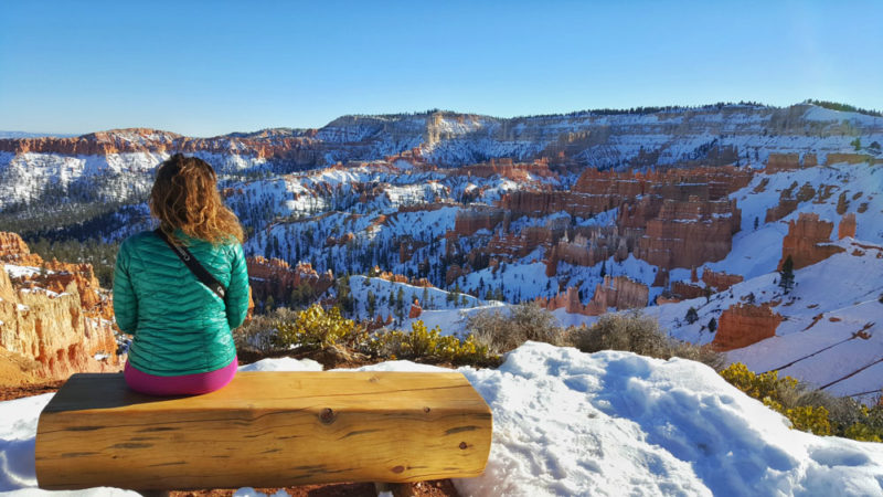
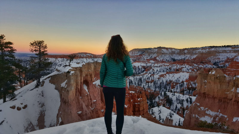
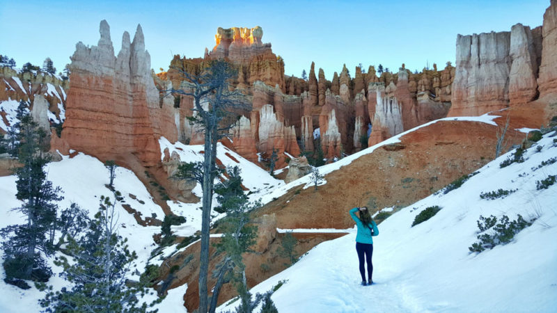
Most people visit the park during the summer. However, depending on the snow levels, we prefer Bryce in the winter. In fact, some of the best pictures we have taken are with the contrast between the red rock and white snow.
Due to its location and high elevation, temperatures get very low at Bryce Canyon, so be prepared for very cold weather during the winter.
Where to Stay When Visiting Bryce Canyon
There are motels, hotels, cabins, and Airbnb options in the towns of Bryce and Tropic. We prefer staying in Tropic, Utah which is a 15-minute drive from the park entrance. There are a few restaurants and better options to stay in Tropic.
Budget Stay: Bryce Pioneer Village in Tropic has double rooms with free Wi-Fi.
Mid-Range Stay: Bryce Valley Lodging offers cute stand-alone cabins in Tropic.
Other Hotels Near Bryce Canyon:
Booking.comBest Viewpoints at Bryce Canyon
- Sunrise Point
- Sunset Point
- Rainbow Point
- Natural Bridge
Best Hikes in Bryce Canyon
Rim Trail – this trail along the edge of the amphitheater is six miles one way. Walk partway or until the end, and return where you started from.
Riggs Spring Loop Trail – this 7.5-mile hike goes through the southern end of the canyon from Rainbow Point to Yovimpa Point.
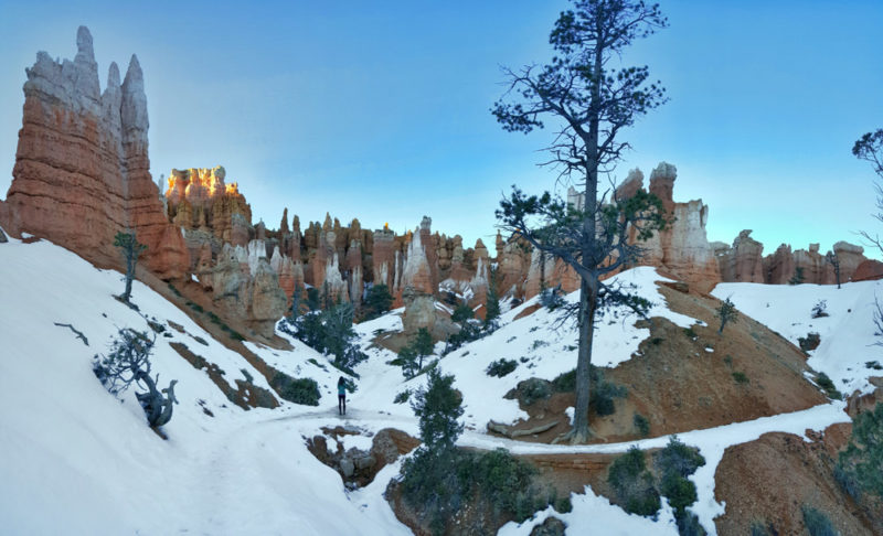
Navajo Loop Trail – this 2.4-mile hike through the hoodoos within the amphitheater begins at Sunrise Point.
Queen’s Garden Trail – this 3.6-mile hike also goes through the amphitheater and begins at Sunrise Point.
Best Day Hike Recommendation
The Navajo Loop and Queen’s Garden trail can be joined to create a loop, starting from Sunset Point and ending at Sunrise Point. This hike takes you through the best of the amphitheater. If you have less time, you can set out on the Queen’s Garden trail.
Queen’s Garden & Navajo Loop Hike Details
Distance: 5.3 miles (8.5 km)
Elevation Gain: 801 feet gain (244 m)
Time: 3 hours
Difficulty: Easy to Moderate
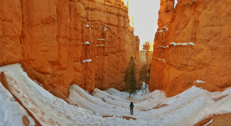
Start the hike from Sunset Point. Hike the Navajo Loop Trail, which begins with a section of switchbacks into the canyon. The first mile is a joined trail for both the Navajo Loop and Queen’s Garden. After one mile, the trail will split.
From the split, you can take the Navajo Loop Trail and return back to this starting point, and combine the hike with Queen’s Garden. For a shorter hike, turn left for the Queen’s Garden Trail.
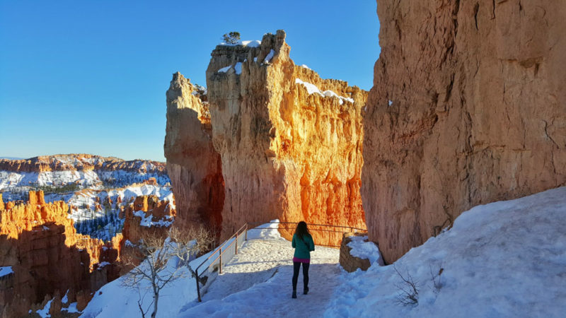
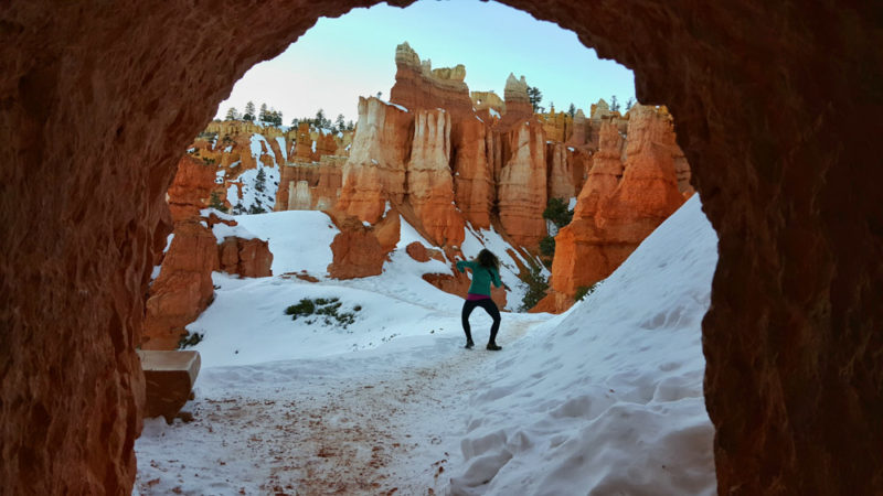
There are several tunnels and narrow passageways along this hike which makes for some unique picture opportunities. This section of the park has some of the best hoodoos and allows you to get right next to them.
The end of the Queen’s Garden hike is at Sunrise Point. This is a 0.5-mile flat walk along the rim trail to get back to Sunset Point where the hike began.
That’s it – have an amazing time Hiking in Bryce Canyon National Park!
Planning a trip to Utah? Check out our favorite books and travel guides!
SHARE THIS ON PINTEREST